

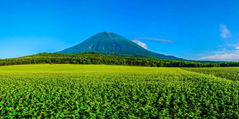
Mt. Yotei (1,898 meters) is an active stratovolcano located in the Shikotsu-Toya National Park in Hokkaido. Yotei bears a striking resemblance to Mt Fuji and is one of Japan's 100 famous mountains. I have always wanted to hike Mt Yotei during the summer, and with the weather on our side, a friend and I chose to give it a crack.
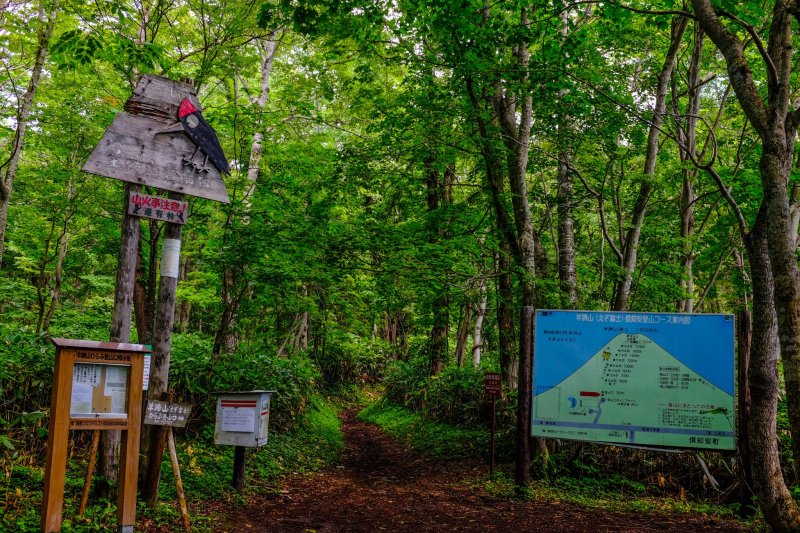
We started our hike at 6am at the Lake Hangetsu trailhead which is a medium to difficult trail that is 6.2 kilometers long and gains approximately 1,590 meters in height. The Hangetsu Lake trailhead is the nearest to Hirafu village and Kutchan and has some of the most challenging sections of all the four trails up the mountain. The hike has an average gradient of 27% and as you get higher up the mountain, the steeper sections become quite challenging with gradients of up to 50%.
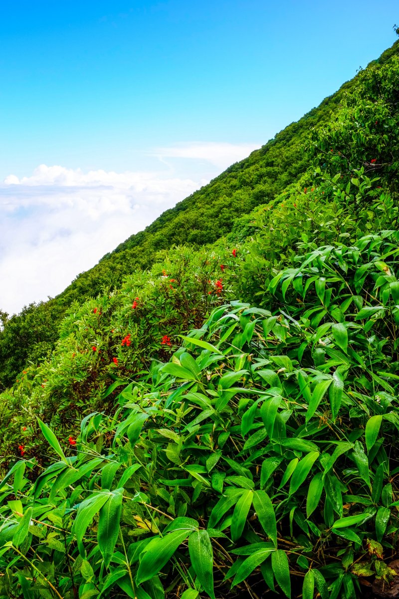
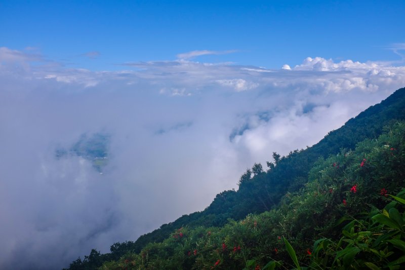
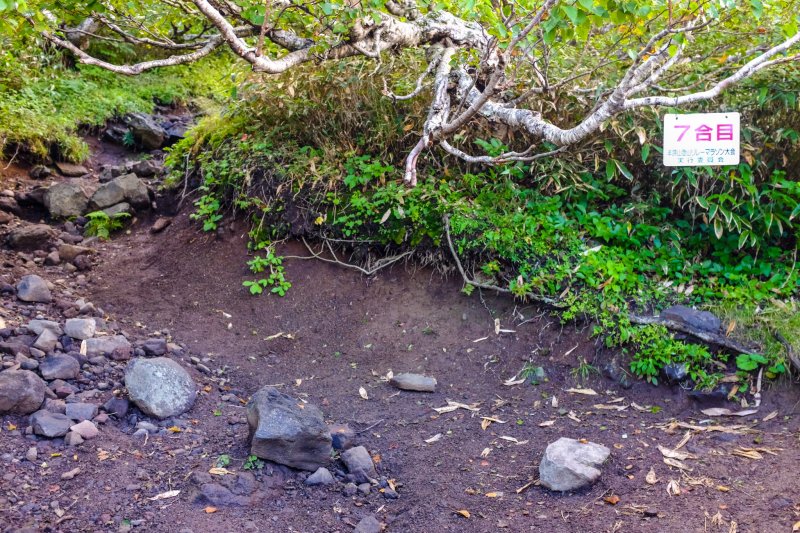
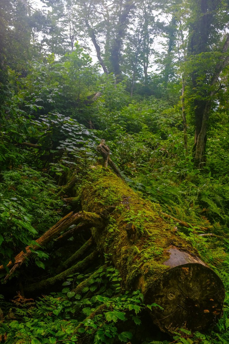
The mountain is split up into 10 stages: The trailhead being stage one, and the peak being stage 10. Each stage represents 10%, so when you get to stage five, you know you are half-way up the mountain. The trail starts off rather gentle and then starts climbing considerably from stage three. There are plenty of switchbacks along the way that provide amazing views across the valley to Niseko and Kutchan, and numerous varieties of alpine flora and fauna that are packed with local wildlife.
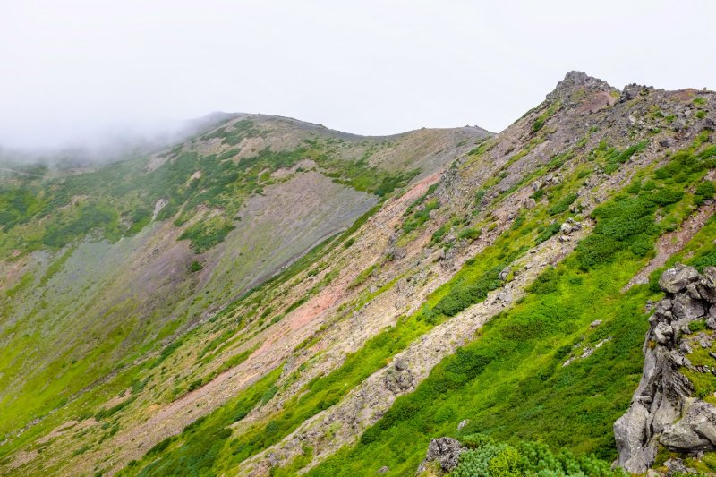
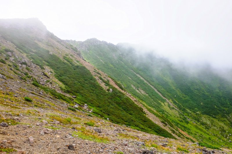
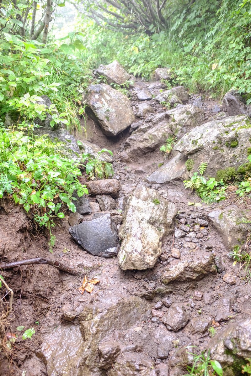
On our way up the mountain, we were surrounded by the drumming of the beautiful Hokkaido great spotted woodpecker and also came across a relatively tame Siberian chipmunk. The hiking trail is very narrow and is made up of dirt and rock, with some sections requiring a hand and feet effort to navigate. The trail weaves its way through the thick forest up until stage nine, where the foliage makes way for volcanic rock. As you reach stage nine, there is an intersection in the trail: Left will take you to the peak, and right to the Mt Yotei hut if you are planning on spending the night.
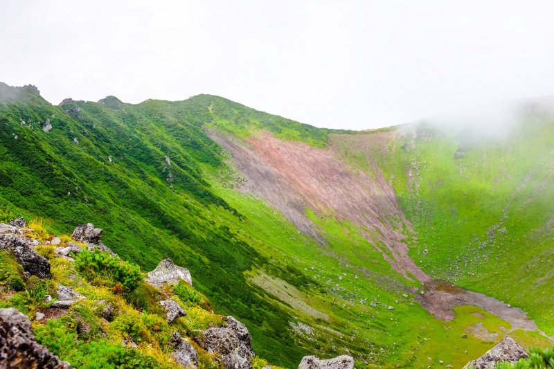
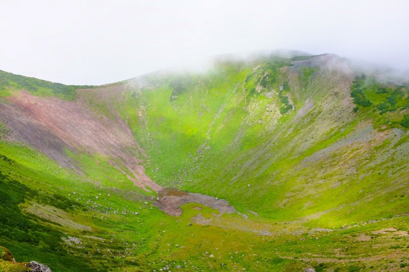
As we reached stage 10, much to the relief of my body, we were greeted with spectacular views of the Mt. Yotei's deep crater. From here you can walk for around the jagged crater rim to get to the highest point on the mountain which is marked with a wooden plank. The walk from Stage 10 to the highest point on the mountain took about 35 minutes and if you would like to walk around the entire crater rim, I would allow 1.5 hours. As we walked around the crater, we enjoyed the constantly changing views as the clouds rolled in providing a really cool and gloomy atmosphere.
Of course it would be fantastic on a sunny day, but I wasn't complaining, I actually enjoyed watching the rolling clouds as they swirled around the craters edge and enjoyed feeling a sense of being up in the clouds, on top of a mountain. We enjoyed lunch overlooking the crater and then started the punishing descent. The descent, in my opinion, is just as difficult as the climb thanks to the steep rocky sections that really take a toll on your knees and quadriceps. The journey down took us 3.5 hours.
If you're thinking of hiking Mt. Yotei, this information may assist in your planning:
- It took us 4.5 hours to reach the peak, and 3.5 hours to get down. If you are less experienced in alpine hiking, I would suggest allowing 6-8 hours for the ascent.
- Pack plenty of water. I consumed 4 liters of water and quite a bit of food. There are no freshwater streams on the mountain.
- I highly recommend hiking poles, especially for the descent. Gloves also come in handy as some sections require you to 'crawl' up.
- If it's forecasted to rain, or has been raining heavily the previous day, forget it. The narrow trail becomes muddy and slippery very fast.
- Collect your rubbish. Don't destroy what you came to enjoy!
To access the Lake Hangetsu trailhead, take Route 5 from Kutchan or Hirafu, and take a left at the Lake Hangetsu entrance. There is a large car park, toilet facilities, drinking water and a small campsite.
Overall, an extremely enjoyable and satisfying experience hiking one of the most beautiful mountains in Japan.


